 You know how to get home, or to your safe-haven retreat location, but what if your usual routes aren’t viable? What if your smartphone’s GPS isn’t working? What then?
This article explains what you need to know about maps and compasses, as well as GPS devices and smartphone emergency apps. Armed with a few basic tools, you can travel quickly, and get to where you need to go, safely.
What if social unrest, or evacuation traffic, blocks your way? What if you need to travel on foot? Can you quickly find a different route? Do you have what you’ll need? What if your family needs to do it without you? This article on maps is the first segment in a three-part series on travel during emergency situations.
In addition to a GO-Bag containing emergency supplies and gear, having the right paper maps and the ability to navigate, is essential. Since your mobile phone may not work, you will need a selection of paper maps, and a compass for direction finding.
Do you have what you need? Would you be able to quickly grab a compass and the paper maps you need? Do you know how to use them to get across town–or out of the county? Are you prepared to walk? And, do your kids and spouse know alternate safe routes and how to adapt? Thankfully, the few simple tools and skills explained in these articles can transform fear and disaster into calm success.
 Paper Maps and Compass: Essential Tools and Skills
Unless you want to avoid being found, it’s foolish not to use a smartphone or GPS for navigation. But it is equally foolish to depend on any electronic device. Batteries die, and electronics break or become disabled, so paper maps and a basic magnetic compass are simple but necessary ‘old-school’ tools.
This article on maps is Part-1 in this “Travel During an Emergency Situation” series. In Part-2, you will find details on compass selection and use. Part-3 focuses on GPS and smartphone apps.
Paper Maps: 3-Types, All Are Essential
Three types of maps are needed to safely and efficiently get from Point-A to Point-B during an emergency situation. All three should be kept in your vehicle and each GO-Bag.
If you are planning a trip, or you routinely travel to a different city, State or nation, you need maps for these locations as well. We don’t know when disaster will strike, so we always need to be ready to roll.
The examples used in this section are for the United States and Canada, but similar maps are available for most of the world through local and online specialty map companies, and sometimes through the national government. For example, the Ordinance Survey agency in the United Kingdom is a source of reliable maps.
Geologic maps of many countries and declassified satellite imagery is also available at USGS.gov. For less developed countries, vegetation, mineral, rainfall, and other special-purpose maps can be useful when standard topographic maps are not readily available.
The 3-Categories of Essential Paper Map
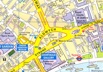 1. Street Maps. If you are in a city or will be traversing a city, an ordinary street map can help you find alternate routes using side streets. This map needs to include ordinary surface streets in neighborhoods in addition to highways and major thoroughfares. Ideally, your street maps will include the names of small residential streets and lanes in addition to thoroughfares, but if not the street names, they should at least be depicted.
 2. State or Regional Map. A single map is needed to provide an overview of the entire area between your point of origin and your various potential destinations. In addition to the route you expect to take, the map should also encompass the various roundabout alternative routes since a detour may become necessary.
The areas included on this map should be more than your home, place of employment, and your safe-have retreat location. Ideally, it will also include the homes of relatives and friends, and other places of safety which you may need to divert to in an emergency situation. This one map can help you gain “big picture” perspective, identify new risks and potential routing problems, and problem solve when circumstances change. You can also use this map to identify where detailed topographic maps are needed.
 If your travel distances are substantial, buy a large format map book which contains an overview map as well as large-scale topographic terrain maps. Delorme makes an Atlas and Gazetteer for most U.S. states. If you will need to traverse several States, buy a large format map book for each one.
If you follow this link to Delorme’s map of Texas, you will see that it is not a detailed topographic map, but it does include land features and other details not found on ordinary road maps. Other map companies produce similar products or individual maps for other countries.
These maps, and some recreational maps such as the Benchmark and National Geographic Adventure Edition collections which provide even less detail, include highways and some secondary and rural roads, but they do not show the spiderweb of unpaved roads which are so important for identifying alternate routes. Plus, they often include other useful information not found on ordinary street and highway maps.
At 11 x 16-inches in size, map books such as the Delorme Atlas and Gazetteer are perfect for use while traveling in a vehicle, but they are too big for inclusion in most GO-Bags. Notwithstanding, it may be advantageous to buy an extra copy of the same map book, disassemble it, and put the relevant pages in your GO-Bag. Keep an intact version of the book in each of your vehicles.
Even if you don’t need these maps yourself for navigation, you may find them helpful if you need to guide someone else verbally, using a mobile phone or amateur (ham) 2-way radio. If you have a shortwave radio to listen to news updates, these maps can also help you chart the location and progress of problems.
 3. Topographic Maps. Printed on paper, custom “topo” maps can be ordered online from companies such as My Topo. These custom maps are your best option. They include roads, trails, terrain and land features, as well as man-made objects such as buildings and bridges, plus the optional details you specify.
Yet another benefit of a custom map is that you will need fewer maps, since a custom map depicts the specific geographic area you need. This is noteworthy if you are carrying these maps in a GO-Bag, or if your route requires multiple maps.
Notwithstanding, combination terrain and road maps such as those created by U.S. Geological Survey (www.USGS.gov) and reproduced by many private companies, are widely available. Stores which cater to serious backpackers, and some sporting goods stores, inventory topographic maps.
Either way, a custom map or a stock topo map can be invaluable in an emergency situation. Not only do these color maps show roads, they also include an assortment of natural and man-made physical features of the geographic area.
A quality topographic map will have useful details such as paved, unpaved roads, and even footpaths. They indicate elevation and the steepness of terrain, high-ground and valleys, bridges, buildings such as hospitals, and landmarks which can help you identify your location. They show sources of water, small villages, fence lines, farm and ranch buildings, and more than 200 other details that might be useful if you are forced to take an alternative route.
If you find yourself walking, you will want detailed maps. These will be especially useful in areas where the ground is hilly or mountainous, or if it is interlaced with streams or rivers, or if the terrain includes dense forests, fissures, or other terrain features which might impede progress or provide respite. Topographic maps which show these features can become valuable assets.
![]() The most popular size of topographical map, is a compromise between high-detail and yet a reasonable size map. The USGS versions of these maps are called a ‘Quadrangle.’ This same map is also known as a “7.5-minute” map or a “1:24,000 scale” (or 1:24) map.
The most popular size of topographical map, is a compromise between high-detail and yet a reasonable size map. The USGS versions of these maps are called a ‘Quadrangle.’ This same map is also known as a “7.5-minute” map or a “1:24,000 scale” (or 1:24) map.
These three terms, Quadrangle, 7.5-minute, 1:24,000 scale, and 1:24, all refer to a map which depicts the same amount of terrain. With this scale of a map, 1-inch on the map represents 2,000-feet of distance, which is slightly more than 1/3 of a mile. The entire paper map includes an area of 49 – 70 square miles. (The number of square miles depends on the size of the paper.)
US Topo. Maps labeled as “US Topo” use a different data source and typically don’t have as much fine detail—but they are often much more current. So, only use USGS US Topo collection maps for areas which have experienced significant changes in recent years.
Military topo maps, and other maps which use the metric system to measure distance, use a similar format but the values are different. So, when considering a map for purchase, first check the map’s legend to see if it uses inches or centimeters. (The ‘legend’ or ‘key’ is like a user’s guide which explains land features. This is located along the bottom margin, but it may be inset, or even on the back of the map.) This same ‘legend’ often contains other useful information, as well, such as explaining map symbols and other map features.
 Map “Scale” Choices: The larger the scale, the less detail. As mentioned earlier, on a 7.5-minute map, 1-inch equals slightly more than 1/3 of a mile. On a 15-minute / 1:62,500 scale map, 1-inch on the map’s surface represents 1-mile of distance, with the entire paper map encompassing an area of 197 – 282 square miles. Whereas on a 30-minute / 1:125,000 map, 1-inch on the map’s surface represents 2-miles of distance, with the entire map covering an area of 786 – 1,124 square miles. Once a map’s scale reaches 1:500,000 where 1-inch equals about 8-miles, the map is only useful for planning and vehicle travel, not orienteering.
Tip: The larger the map’s scale number (ex. 1:150,000 vs. 1:24,000), the larger the number of square miles included on the map. With this in mind, you may want a USGS 1:12,500 scale map for the immediate vicinity around a place of interest, such as your home or safe-haven location, plus 1:24,000 scale maps for the adjacent areas, and a large-scale map for the region.
The greater the number of land features in an area, such as hills, streams, structures, and impediments to travel, a small-scale map will be more valuable. Whereas in an area with flat terrain, such as a desert or plain, where there are few features to interfere with travel, a larger scale map may suffice.
Practical Considerations: Though the amount of detail on a 7.5-minute / 1:24,000 makes it the standard scale map used for off-road trekking and foot travel, it may be impractical to carry the number of paper maps this would necessitate. So, compensate for this by selecting 15-minute or 30-minute maps (or a larger scale map) for areas which are flat uninterrupted terrain. And, smaller-scale maps such as the 7.5-minute maps when the additional detail might be valuable.
Sources of Topographic Maps: Topographic maps can be ordered direct from the USGS, but in typical government fashion, the government’s website can be difficult to navigate. However, the USGS does maintain a database of maps for other countries as well as the United States.
Thankfully, these same USGS maps, some with additional enhancements, are also available from online vendors such as www.mytopo.com. Whichever source you use, check the date of the map. If it’s not within the last decade or two, compare it to maps available from other sources.
Sometimes the newest maps are quite old, but this may not matter if there have been few changes to the land. While with other areas, a dated map might introduce problems or benefits to navigation or safe travel. Factors such as population growth, the addition of freeways, commercial zones, dams and reservoirs, and other terrain-altering developments can affect your travel plans.
 Hybrid Maps – Topographic on Satellite Photo: Vendors such as My Topo also offer hybrid maps which superimpose satellite imagery on top of a road map, but these are not as useful as they might seem. Most experts agree that a full-color topographical map provides far more useful details for land navigation.
Consider Buying Custom Topo Maps. On websites such as MyTopo.com, a custom map is not necessarily much more expensive. They may even represent cost savings when you consider that you’ll need fewer maps.
Custom maps make it possible to select only the specific areas you need for your route, rather than needing additional maps because your route takes you across the corner of several pre-printed Quadrangles. And, if purchased from a quality supplier, these maps can be far more durable than those made by the USGS.
 Map Grids: As an aid to navigation, many topographic maps have a grid of black or colored lines superimposed on the map. Or, tick marks which can be connected to form a grid. These grids aid navigation, but they can also be confusing for those who don’t understand that there are different grid systems. Whenever possible, those who are new to land navigation should select maps which use the same grid system. Fortunately, many modern maps incorporate at least two different grid methods on the same printed map. If you are orienteering with others, you will find it helpful to use the same map and grid system. The most common and popular grid system is UTM (Universal Transverse Mercator).
What to Order: It’s easy. Select the features you want, and design a map that is exactly what you need in less than 5-minutes. Simply zoom in on the vendor’s online map until it reveals the specific area you want to include on your map or use the address or zip code. Then, drill down until you reach the scale of map you want to print. With each step, place your computer mouse cursor in the middle of the map, left click and hold to adjust and center your map.
If you plan to make a custom map of your safe-haven retreat location or some other specific property, you may want to place that site in the center of the map. Or, maybe you want it to be off-center so that your map shows more of the area approaching the property, or your evacuation route. Either way, don’t miss this opportunity to be intentional about adjusting the layout to maximize the usefulness of the individual map sheet.
 Custom Maps – Order Specifics: If you are using My Top Maps Company, here are the four simple steps for building your own custom topographic map. (If you are not interested, skip down to the next bolded subtitle of this article.)
Step-1: First, in the title bar, select “Online Maps.” Then, click on the button, “Search or Zoom in for More Detail”
Step-2: Select “Topo Maps.” If you want to add “Private Property Lines” or “Public Land Boundaries,” click on your choice. Chose the paper size you want. Most people favor either 24×36-inches or 36×48-inches. Remember, for use in the field you will want to fold the map, so the larger size may not be a problem. Next, select the orientation of the paper; “Wide” (portrait) or “Tall” (landscape).
Inside the red box on the map is a red “+“. Click and hold down the left button on your map, and reorient the red square to include the area you want to be included on your map. Once you have the red box positioned, release the left button on your map. Click on the “+” again, briefly, to lock the position of the boundary box. Now, click on the “Preview now>>” button to view an image of your custom map.
Left click on the image to enable scrolling, so that you can inspect map details. Close the window containing the map. You can now go back and continue editing details or reposition the map. When you’re done, click on the lower left box, “Continue to Step-3>.”
Step-3: Choose either paper “Waterproof Outdoor Map” or plastic “Laminated Map.” The cost is the same. Most people favor waterproof paper maps for use in vehicles and for GO-Bags, and laminated maps for mounting on walls and command-post use.
If you selected waterproof paper, choose “Folded” or “Rolled.” Most people prefer folded maps for use in vehicles and GO-Bags.
Step-4: If desired, add your name and personalize information. This will be printed on your map at no extra charge.
Navigational Grids: “Lat/Lon.” If you will be primarily using latitude and longitude for finding locations, click on “Full Grid Lines.” This is an uncommon choice unless your map will be used to coordinate search and rescue efforts or landing zones for medivac helicopters. Most people select, “Tic Marks” in this Lat/Lon category as this adds the information as little marks to the map and its margins, so the grid lines can be added later if they are ever needed.
 Navigational Grids: “UTM / MGRS (Military Grid) / USNG (US National Grid).” If in Step-2 you selected “Private Property Lines” or “Public Land Boundaries,” you may want to choose “Tic Marks” rather than a grid. If you add the grids to the map plus property lines or land boundaries, the map can get very “busy” with a lot of competing information. Therefore, we recommend that you only add “Tic Marks” if this is what you selected in Step-2. However, if you did not select either of these boundary options, you probably want to add “Full Grid Lines.” Grid lines are very useful for navigation.
Datum/GPS Setting. Leave on “Standard” unless you have a GPS that uses an older standard.
Shaded Relief (Below Photo). Choose “Enhanced topo, add relief shading” unless you are a purist and want an unadulterated USGS topo map. In our experience, adding the shading to the map is a nice touch as it creates a 3D effect. This shadow-effect makes terrain fluctuations more visible, especially for those who are less experienced. Yes, the contour lines do the same thing for those who are experienced users, but many seasoned orienteers still select this shading option. The maps examples on the webpage illustrate the effect of this option.
Preview. Click on the “Preview” button to review your order. If everything is correct, you can “Print Proof” to “view a preview of your printed map.” If you are satisfied, click on the “Add to Cart” button and complete the purchase process.
Summary. Select a map scale and paper size to match your need. Most people favor the 1:24,000 scale (“7.5 minutes”). A map such as this printed on waterproof paper can be purchased for as little as $15 when ordered online from My Topo Custom Maps.
If you don’t want to print multiple 1:24,000-scale maps for the area around your safe-have retreat location and your intended travel route, while 1:62,500-scale maps don’t have the same amount of detail, they also don’t require as many map sheets. As a result, you don’t need to purchase or carry, as many maps. Maps using a scale of 1:62,500, and even larger ones, can still be very useful if it is impractical to use 1:24,000-scale maps exclusively.
 My Topo Custom Maps is our favorite vendor, but there are others. This one is our favorite because their website is intuitive, you can call their Customer Service department for help, they ship quickly, and they provide quality products at reasonable prices.
Owned by Trimble, ‘My Topo’ was founded in 1999. If you don’t recognize the name, Trimble is the company which makes survey equipment used to plot roadways, and they also make Terrain Navigator, the computer software often used by engineers for site development. So, they know what they are doing when it comes to producing maps.
USGS Quadrangles. If you don’t want a custom map, My Topo’s website and others make it easier to find the map you need, so you don’t need to experience the frustration of shopping on the U.S. government’s website. USGS, Ordnance Survey maps, and other government-produced pre-printed topographic and special-purpose maps can be purchased at reasonable prices from a number of online vendors. It is more difficult to find the maps you want from brick-and-mortar stores, and their prices are often significantly higher.
 Map Tools: Two tools are important for land navigation. 1. A flexible clear-plastic ruler with inches on one side and centimeters on the other edge. 2. A clear plastic protractor with tick marks at 5-degree increments (or smaller). These inexpensive little tools can be a great help for measuring distances and establishing routes on paper maps.
For those who are more serious about navigation, as well as those who don’t want to bother with the basic math calculations required for navigation, there are various simple-to-use ruler/protractor/grid tools which make the task easy and quick.
These pocket-size plastic tools are map-scale specific. They can be used to measure distances, and to transfer compass information onto your map so that you can set your bearing (direction of travel). They also can be used for various other land navigation purposes. For more on this subject, at the end of this article you will find a link to a video, “Using a Compass, Paper Map, and Grid Tool.”
Map Tool Recommendations: Your decision as to which map tools you should choose will be based on your need, but in the following paragraph and in the section on video tutorials, you will find information on several popular map tools. This is a good place to get started.
You might want a single map ruler for 1:24,000 scale maps or a set of four map rulers for different map scales. A popular universal multipurpose tool is the Super GTA. The Super GTA is an improved version of the military MGRS/UTM coordinate grid reader and protractor. But whichever tools you select, make sure they match the scale of the maps you will be using.
Other Maps and Do-It-Yourself (D-I-Y) Maps
 Google Maps, Apple iOS6 Maps, and Google Earth. Unfortunately, maps printed directly from these “free” online sources have insufficient detail. However, by subscription, high-resolution satellite image maps are available from various sources. Though interesting and perhaps valuable for certain purposes, they are generally not helpful for navigation.
Protecting Paper Maps: Office supply companies and some online map companies such as My Topo, provide plastic laminating services to make paper maps more durable. Notwithstanding, laminating can make a map cumbersome to use and difficult to transport. Because of this, rarely are laminated maps a viable choice for inclusion in a GO-Bag. However, laminated maps do work well for use at home or in the field near your home or retreat location, command post, or for disaster-response teams. But most laminated maps must be rolled and take up a lot of space, so they are not compact enough for evacuation use, or for inclusion in a GO-Bag.
D-I-Y Waterproofing of a Paper Map: Map coatings (paint), using waterproof printer papers, and clear packing tape, are waterproofing/water resisting / durability-enhancing methods you can accomplish yourself.
 Aquaseal aka/ Map Seal. Can be used to ‘paint’ a waterproof coating onto your paper maps. This treatment makes them water-resistant and also more durable and tear resistant, but it is important to follow the simple directions precisely and to let the map dry thoroughly. Importantly, AquaSeal treated maps are still compact and can be folded to save space. This is a good product, but not a fabulous one.
Packing Tape. If you don’t want to use a product such as AquaSeal, clear packing tape can be used to provide a modicum of protection for paper maps. With the map opened and flat on a tabletop, run a strip of clear packing tape over each fold crease, and then refold the map, and run the rounded bowl of a spoon over the fold to flatten it. This method doesn’t work as well as AquaSeal, but it is an inexpensive alternative for making your paper maps more durable.
 Waterproof D-I-Y Paper. The best option is to buy paper maps that are professionally printed on waterproof paper. But for the do-it-yourself crowd, there are several companies which sell waterproof computer printer paper. But surprisingly, the per-map cost isn’t that different from buying a custom-printed map. Additionally so, when you consider that unlike a custom map, it is often necessary to print several maps because your area of interest spans more than one map.
D-I-Y Map Sources: ‘Free’ maps can be downloaded from USGS.gov and other online government and commercial sources. These you can print on any color printer, but waterproof computer paper is a good idea unless you intend to laminate your maps. Unfortunately, many of the retailers of these specialty papers only sell waterproof paper in 8-1/2 x 11-inch, 8-1/2 x 14-inch, or A4 sizes. Most people find this to be too small for field use.
Thankfully, a few manufacturers, such as iGage Waterproof Papers and Rite-in-the-Rain, do offer waterproof paper in 11 x 17-inch size. Still, a laser jet printer is needed because inkjet printers use water-soluble inks. So, if you use an inkjet printer, though the paper won’t dissolve when it gets wet, the ink can easily wash off the paper. Therefore, waterproof papers made for inkjet printers are problematic. It’s really not worth attempting unless you have access to a color laser jet printer.
Size of Maps: Even if you have access to a color LaserJet, most people prefer using larger maps. Either 24 x 36” or 36 x 48” maps are the most popular for travel and fieldwork.
These larger sizes are far more useful for plotting routes and navigation: Open the map to its full size, then refold it to a smaller, more manageable size with the area you are traversing on top. A large map, properly folded, will expose the portion of the map currently needed, while the rest is tucked away, ready for successive use.
A commercially made, custom map with your area(s) of interest in the center, can be a cost-efficient and space-saving alternative. These maps tend to be much more water resistant than any of the do-it-yourself methods.
Plastic Bags / Map Cases: Whether you use AquaSeal, packing tape, waterproof paper, a commercially produced waterproof map, or no treatment at all, for added protection, use a clear plastic bag or map case to protect your maps.
A simple, compact solution is to double bag your collection of maps using two jumbo-size Hefty-Slider Ziploc-style transparent plastic bags. Freezer bags which are 2-1/2 gallon-size, or larger, work best for this purpose.
When it comes time to use a map, remove the one you need and refold it to fit the interior dimensions of the plastic bag. This will provide added protection for the map you are actively using, and the other bag will protect your map collection and keep them together.
Short Video Tutorials and Recommended Books
 Video – How to Read a Topo Map (4-minutes) REI
Video – Using a GPS, Paper Map and Grid Tool (8-minutes) MapTools.com
Video – Using a Compass, Paper Map and Grid Tool (5-minutes) Steven Hoober
Video – Using a Compass to Set Your Direction of Travel [Bearing] (3-1/2 minutes) MapTools.com
Video: How to Use a Military Lensatic Compass (30-minutes) U.S. Army
This video is an old U.S. Army training film which teaches direction finding and navigation using the military-issue compass and military grid map (MGRS). Despite the age of this video, the content is excellent. Note: There are various map grid methods in addition to the one used by the military.
Web Resource – Map Grids: Selecting a Geographic Coordinate System
Book: “Be Expert With Map and Compass: The Complete Orienteering Handbook,” by Bjorn Kjellstrom (founder or the Silva Compass Company), and his daughter, Carina Kjellstrom Elgin. This book contains simple and straightforward instructions for the novice. Don’t be misled by the chapter titles as they don’t adequately describe the content of that portion of the book.
Book: “Map Reading and Land Navigation, FM 3-25.26,” U.S. Army Training Manual
This manual is particularly useful for anyone who will be using a military-style Lensatic compass such as the Cammenga 3H Tritium, Cammenga 27CS, or similar compass.
 Practice. Make Practice Fun.
Geocaching is an increasingly popular treasure-hunt game typically undertaken with either a GPS device or a smartphone using a GPS map app. It is popular among adults of all ages, as well as parents and children of all ages.
If you are new to land navigation this a good place to start developing orienteering skills as there are many ‘caches’ already hidden that you can find. If you incorporate the use of a paper map and location-finding with the game, it can be a fun place to start learning, but don’t stop there.
As soon as you are comfortable with using a GPS for this new use, create your own game using each of the three different types of maps (street map, regional, and topographic quadrangle), plus a compass and protractor. At this point, land navigation (orienteering) can become serious fun, and seriously useful. These basic skills can make travel during an emergency situation manageable, far safer, and help you arrive at your destination quicker.

You must be logged in to post a comment.